
TL;DR:
- Pack both analog tools and digital backups, and practice with them before you head out.
- Set clear communication protocols and pacing plans to keep your group close and safe in low visibility.
- Manage power, carry redundant navigation devices, and rehearse emergency backup procedures.
Imagine leading a team through a dense, uncharted forest where the path is faint and the stakes are high. Just like in marketing, successful navigation in the backcountry relies on preparation, real time tracking, and clear communication. If you are used to tracking campaigns with analytics and coordinating teams across channels, many of those same principles will help you guide a group through remote terrain.
In this guide you will get practical, tactical advice for a backcountry backpacking adventure. I will walk you through essential navigation gear, digital and analog tools, methods for keeping a group close when visibility drops, and a clear comparison of navigation approaches so you can pick what fits your trip and team. Think of this as a field manual for leaders who want to translate marketing smarts into wilderness safety essentials.
Table of Contents
- Essential Navigation Tools for Your Backcountry Backpacking Adventure
- Strategies for Staying Close and Maintaining Team Cohesion
- Comparing Navigation Methods for Wilderness Success
- Frequently Asked Questions
- Final Thoughts
Essential Navigation Tools for Your Backcountry Backpacking Adventure
Before you step into the trees, assemble a navigation kit that fits your route, team size, and comfort with tech. The right mix of analog skills and digital aids gives you resilience. For marketers and small business owners who run campaigns and travel with teams, the same habit of redundancy and tracking applies here. Treat your navigation kit like a campaign stack, with primary systems, secondary systems, and hard fail safes.
Topographic maps and reliable compasses
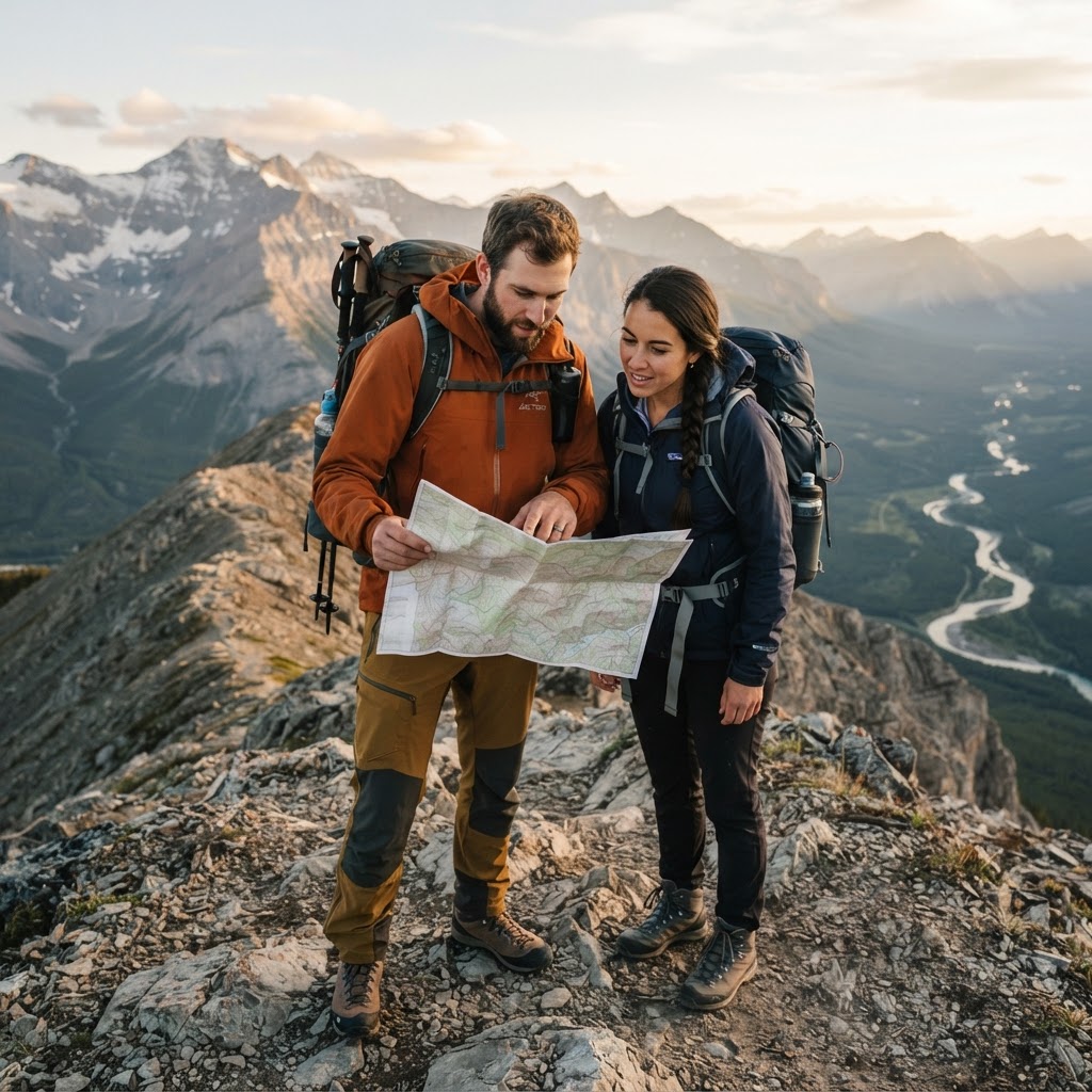
Topographic maps are the foundational document for any backcountry backpacking adventure. Read them the way you read a campaign plan. Contour lines show elevation and slope, symbols mark water and trails, and scale tells you how long a section will take. A physical map does not need power, it cannot lose signal, and it gives a shared reference everyone can see.
A reliable compass pairs with your map to convert map orientation into real world movement. Practice taking bearings and following them before your trip. Teach one or two team members how to relocate themselves on the map using terrain features. That shared skill turns navigation from a single person responsibility into a group capability, much like training a team to read analytics dashboards.
Using GPS devices and offline mobile apps
Dedicated GPS units and offline mobile apps add precision and convenience. GPS units give coordinates and track routes, and they often include topographic data that mirrors paper maps. Offline apps allow you to download maps ahead of time, record tracks, and mark waypoints. They are excellent for logging progress, which translates well for marketers who are used to analyzing clicks and conversions.
When you rely on digital devices, plan for signal gaps and battery loss. Download offline maps, set up custom waypoints for camps and water sources, and practice using the device interface in the field. Make sure multiple people know how to use the app or device, so if one person is busy with other tasks, navigation still continues smoothly.
Strategies for Staying Close and Maintaining Team Cohesion
A group that stays together is safer and more resilient. In challenging sections, poor cohesion causes stress and slows progress. Apply leadership techniques from team management to the trail. Clear roles, predictable communication, and agreed pacing create trust. These methods keep morale high and reduce the chance that someone wanders off or becomes separated.
Establishing communication protocols on the trail
Set a communication plan before you start walking. Decide how the group will pause, how leaders will signal changes in direction, and what to do if you encounter low visibility. Use short, consistent signals such as call and response phrases, and rehearse them so responses become automatic under stress.
Designate a lead navigator and a sweep person who stays at the rear. The lead makes route decisions, and the sweep confirms no one is left behind. Establish a check in cadence, for example every 30 minutes or at obvious landmarks, where the group stops and confirms positions and status. If you use two way radios or other devices, set channels and test range before you leave the trailhead.
Pacing strategies for different skill levels
Group pacing needs to respect the slowest reliable person while keeping momentum. Break the day into segments that include frequent short breaks, and schedule longer rests for meals. Communicate expected pace in terms of time and terrain rather than distance. For example say, we will take this section at an easy pace for 45 minutes, then stop for water. That gives clarity without fixating on distance which can fluctuate with conditions.
If skill levels vary widely, run the trip like a multi level campaign. Plan for optional side trips for faster hikers, or establish meeting points where the group will reconvene. Rotate leadership so everyone has a chance to guide, and use pacing markers like trees or rock formations to keep people aligned. These simple structures help teams maintain cohesion while allowing flexibility.
Comparing Navigation Methods for Wilderness Success
Choosing navigation technology is about balancing accuracy, reliability, and the realities of your trip. Some methods excel in long term reliability, others provide convenience and data. Below is a concise comparison to help you decide which mix suits your backcountry backpacking adventure.
Traditional analog vs digital hybrid approaches
Analog tools like the map and compass are resilient because they do not depend on batteries or satellites. Digital tools provide real time coordinates and easy route logging. A hybrid approach combines the strengths of both. Carry a map and compass as your primary safety net, and use digital devices for convenience and extra situational awareness.
For teams with marketing or project management experience, think of analog tools as your core process, and digital devices as your analytics layer. The analytics help you learn and improve future trips, while the core process keeps you safe if analytics fail. Training in both systems ensures redundancy and gives leaders multiple ways to solve problems on the trail.
Battery life management and backup systems
Battery management is a strategic skill. Start with fully charged devices, then ration use based on need. Turn off unnecessary features like wireless syncing, reduce screen brightness, and use power saving modes. Carry at least one external power bank that is fully charged, and consider a solar option depending on season and exposure.
Backup systems are simple but effective. Carry spare batteries for devices that use removable cells. Store printed map copies in waterproof sleeves. Place a secondary navigation device such as a dedicated GPS or a second phone in a separate pack pocket. Redundancy reduces single points of failure and aligns with the disaster recovery planning familiar to entrepreneurs.
Making the final decision
Pick tools based on the mission. For fast, light day outings, an offline mobile app backed by a paper map may be enough. For multi day trips in unfamiliar terrain, emphasize analog skills and carry a dedicated GPS unit as a navigation companion. Train with the gear before the trip so you know how it behaves under stress.
Pro tip: Run a weekend practice mission where the leader navigates with a map and compass while others follow only using a GPS trace. Swap roles on the return leg. This builds redundant skills and gives the team confidence in both systems.
Frequently Asked Questions
What is the most reliable navigation method for backcountry hiking?
The most reliable method is the one that does not depend on external power or signals, which means a topographic map and compass used by people who know how to use them. Dedicated GPS units and offline apps add accuracy and convenience, but they should be treated as complementary to the map and compass. Redundancy matters, so carry more than one navigation method and practice them before the trip.
How do I ensure my group stays together in low visibility?
Establish simple, repeatable communication protocols and roles before the trip. Use a lead navigator and a sweep person at the rear. Agree on clear call and response signals, stop at regular intervals to confirm locations, and set a conservative pace that suits the slowest reliable hiker. If visibility drops, shorten the spacing between people, use voice calls periodically, and find a safe spot to regroup if needed. Training and rehearsal make these behaviors automatic when stress is high.
What should be in my emergency backup navigation kit?
Your emergency backup kit should include a waterproof printed topographic map of the area, a reliable compass, a spare GPS unit or a second phone with offline maps, extra batteries or a charged power bank, and a simple signaling device such as a whistle or a mirror. Include written notes with planned routes and estimated times for key segments. Store items in waterproof cases and distribute them among team packs so a single lost pack does not remove all navigation capability.
Final Thoughts
Preparation, redundancy, and clear communication are the pillars of a successful backcountry backpacking adventure. Treat navigation like a campaign, measure progress, and keep the team aligned, and you will return with better stories and stronger team bonds.